Trekking Luchon
DISTANCE
53km
ELEVATION
4.190m
Four-day trek that runs through the spectacular French Pyrenees located north of the Benasque Valley. Leaving Llanos de Hospital, stages await us to cover high mountain terrain., with incredible views, more of 14 ibones, few people on most of the itinerary and a succession of postcard-perfect green valleys.
Depending on your preferences, we can lengthen or shorten this trekking. Consult with our guide to draw up a customized itinerary..
When making your reservation online, You will receive at home the wellcome pack and a dossier with detailed information about the trekking.
The giants of the Pyrenees
Trekking Luchon
Do you need help to make your reservation?
Talk to us, we will be happy to help you.

Personalized attention
It will be a pleasure to help you at all times
Check other services included >

Security
Stay connected to shelters with a station.
very easy to use>

Crampon rental ,ice ax and helmet
Delivery and collection of the material in Renclusa
Availability inquiry >
Trekking sections
Trekking over high mountain terrain, technically it is not difficult, although the terrain on which it progresses combines poorly defined trails with other very easy and winding ones.. It is divided into four stages. The approach to the Maupás Refuge and from this to the Venasque refuge is perhaps the one that requires paying the most attention due to the type of terrain on which it progresses.. In summer there is a bus service from Besurta to Llanos de Hospital.
If you prefer, speak with us.
STAGE 1
Hospital Plains-
Maupas Refuge
Approximate time
5h 30 m
Elevation gain +
1.140 m
Distance
8’79 km
Elevation loss -
430 m
STAGE 2
Maupas Refuge – Refuge Venasque
Approximate time
7h 35 m
Elevation gain +
1.070 m
Distance
14,4 km
Elevation loss -
1.280 m
STAGE 3
Venasque Refuge-Artiga de Lin Refuge
Approximate time
4h 15 m
Elevation gain +
310 m
Distance
7’8 km
Elevation loss -
1.130 m
STAGE 4
Artiga de Lin Refuge – Renclusa Refuge – Llanos hospital
Approximate time
5h 05 m
Elevation gain +
780 m
Distance
12,4 km
Elevation loss -
510 m
FRANCE VARIANT
Venasque Refuge-Artiga de Lin Refuge
Approximate time
7h
Elevation gain +
1.030 m
Distance
15’6 km
Elevation loss -
1.800 m
Shcedules and prices
Bus Aneto - Besurta
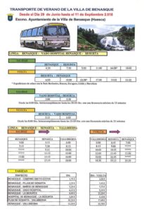
From June 29 to September 11, the bus service from Benasque to La Besurta and vice versa is activated.
Benasque - Besurta
First bus
4:30 A.M
Last bus
16:00p.m
Besurta - Benasque
First bus
6:00 A.M
Last bus
21:00p.m
Hospital Plains – Maupas Refuge
Old port of Benasque – Lac du por well – Lac Celinda – Lac Charles – Lac Blue – Maupas Refuge
Distance
8’79 Km
Elevation gain +
1.040 m
Elevation loss -
430 m
Approximate time
5h 30m
Stage to start good morning and with full strength. We will start with a direct climb to the Old port of Benasque. You have to pay close attention to the track, Well, he leaves the main road and without any markings on the ground he ventures into a hidden valley.. The climb to the hill is poorly defined, there are some milestones. Once on the hill we are in france, We will go down directly without stopping paying attention to the GPS as we will leave the main path again before reaching the first Ibón. ( in france lac) of the journey, the Lac du Port Vell. We will make a small climb to a hill where we will see the Lac celinda a few meters below and we head towards it, changing valley. In a gentle descent and on comfortable terrain we will reach the Lac Charles , a small comeback and we will have a delicate descent, not difficult, but with rain it can be very dangerous. There are some sections equipped with cable. We continue along a completely flat road in very good condition.. We arrive at Lac Blue and we cross it on a very solid metal bridge. Throughout this section we have incredible views of Bañeres de Luchon and the stage that awaits us the next day.
To get to the refuge you have to deviate no more than 15 minutes of the route. Welcome to a typical French refuge, very basic, but with everything you need to rest and regain strength in an incredible location.
Maupas Refuge – Refuge Venasque
La Renclusa Refuge – Plan d’Aigüalluts – bull collar – Ibon de Toro de Salenques – Artiga de Lin Refuge
Distance
14,4 Km
Elevation gain +
1.070 m
Elevation loss -
1.280 m
Approximate time
7h 35m
It is advisable to leave the Venasque Refuge very early, We will start with a drop of 400 meters of negative slope and we will take a very defined path that will very gently reach the incredible Lac Verd. We will continue on a gentle climb to a shepherd's hut; «Abri de Gaures» where we can load water. We will make a short climb from where it is a good place to contemplate the environment in which we find ourselves., It's really majestic. Now we have to go up gently along an aesthetic path that winds up to a hill that will open our minds.. From here we will see a postcard image, on the one hand the steep mountain backdrop that we have overcome and on the other a completely green valley with a very aesthetic path that flanks it to another hill at the same height. It is truly a scene that will remain forever etched in your retina..
Now yes, a direct descent while we contemplate the Cirque de la Glera and a direct climb along an indistinct path to the Maille Lake. It is important to follow the GPS as it is a very steep terrain.. From here, in a more gentle way, we go back to the aesthetic Montagnette Lake with the Safeguard Peak as a backdrop. It is truly an incredible sight that makes up for the climb we just made. If we go with enough time and the weather is good, It's a good place to take a breather and just contemplate. From here we only have to go up to the hill that will show us our final destination for this day. During the descent to the refuge they will be uncovered as we advance and with the orography of the terrain, up to a total of 4 lakes around the aesthetic Refuge de Venasque. A functional design construction, very well thought out, with all the services and with very exquisite attention from the guards. Without a doubt a must stop after a hard but beautiful day..
Venasque Refuge -Artiga de Lin Refuge
From France to the Vall de Arán through the port of La Picada
Distance
7,8 Km
Elevation gain +
310 m
Elevation loss -
1.100 m
Approximate time
4h 15m
Before leaving the RI escape from Venasque 2.249 m
We can decide whether to do the original stage or if we have good strength and time is good we can do the Hospice de France variant.
If we opt for the original stage, we leave the Venasque refuge behind while we border the lake, we start along a very well marked path in a southerly direction that, as it goes up, becomes steeper and steeper.. We now enter Spanish territory through the mythical Portillón de Benasque 2.444 m from where we will have the most spectacular view of the Maladeta and Aneto glacier m from the entire Benasque Valley.
From the same hill we can decide if we do the Safeguard Peak 2.736m. It is a round trip itinerary along the same path only recommended on days with good visibility and no risk of rain.. You can see the description in Safeguard Variant
From Portillón de Bemasque, almost flanking through more uncomfortable terrain, we arrived with little time at the Puerto de la Picada 2.475m. Next, along a much more comfortable path, we reach the Coll del Lunfern where we are already in the territory of the Aran Valley. To our left we will see an aesthetic path called Step of the Escaleta where we would enter French territory again and from where it would be linked to the Hospice de France variant.
From the Coll de Lunfern we only have to go down an open valley of low vegetation with a large presence of cattle. Because of this, it is important to pay attention to the path and follow the course of the river along the canal of Pomero. At the end of the valley the landscape will change radically and we immerse ourselves in a beautiful beech forest, leaving behind the hills and panoramic views to focus on the capricious details of the forest.. We will cross the river on an aesthetic metal bridge and descend along a track and path we will finish enjoying the beech forest before going out to a spectacular alpine meadow where we will find the renovated Artiga de Lin Refuge 1.465 m.
Without a doubt a very varied stage in terms of landscapes and with little difficulty, ideal to recover from the previous day.
Artiga de Lin Refuge – Renclusa Refuge – Hospital Plains
Artiga de Lin Refuge – Coll de Toro- Renclusa Refuge – Hospital Plains
15Distance
8 Km
Elevation gain +
410 m
Elevation loss -
930 m
Approximate time
4h 15m
We leave the Artiga de Lin Refuge and stand in front of the imposing Coll de Toro. We begin to climb gently at first and inevitably it becomes steeper and steeper.. There is some section with metal cable, There is no technical difficulty, it is just the slope of the terrain..
We arrive again at the Benasque Valley and immediately also at Ibón de Toro 2.223 We skirt it on the right and are almost forced to stop on its shore to contemplate the Maladeta and Aneto glacier.
We make a small comeback to the Coll de Toro and already on the way down the valley opens infinitely as we continue descending until we are above the Plan of Aigualluts. It is truly a spectacle of landscape that we can enjoy without rushing and along a very comfortable path to walk..
Once in Pla d'aigualluts we follow the plain on the left side where there are some wooden walkways. Before heading up to the Renclusda Refuge, it's worth a little detour to enjoy the spectacletoass offered by the waterfall and the «Best» the sink of Aiguallut.
We ascend along a path to Cuello l'Anclusa and we go down to the La Renclusa refuge (2 140 m) where we can get supplies or spend the night. From here we follow the path to Besurta from where we can take the bus in case we no longer have enough strength.. Or continue comfortably and with hardly any unevenness to Llanos del Hospital where we will close the circle of the trekking we have done. .
Peak Safeguard Variant
Distance
3,13 Km
Elevation gain +
300 m
Elevation loss -
300 m
Approximate time
2h 0m
Peak Safeguard 2.736 m it is one of the most accessible peaks within the valley in summer, although it has its difficulties. From the Puerto de Benasque we will follow the path that goes to the left and that goes up the crest. A zigzag path that you have to walk carefully, there is even an area of large rocks secured by a string to progress more safely.
The final part is much easier, even the final crest section has no difficulty. You have to be careful in case of snowfields and assess the situation well.
Schedules and prices Bus Aneto
HOSPITAL PLAINS – BESURTA
In Llanos del Hospital you can leave your car in the parking lot before a barrier on the left, well from that point, from the 8:00 and until 20:30They leave for Besurta with a maximum frequency of 35 minutes.
RATES
If you take your car up to the hospital plains and take the bus from there to La Besurta, the round trip will cost you 5,10€.

